 Kocaeli
Izmit is the central district of Kocaeli. It is located in Çatalca - Kocaeli Department of Marmara Region. The population is 294,875 as of 2010.
Historical
Izmit and around the prehistoric times around BC. From the year 3000, the results of the researches that people have experienced have come out. The first evidence belonging to İzmit is BC. It dates back to the 12th century. At that time the Phrygians protected the region, then a group of immigrants who set out from the city of Magara in Greece, gave the name of Astacus to the region where Başiskele is today and settled in this region. The end of the destruction of the Astacus by the king of Thrace Lysimakhos, a new city called Nicomedia was established in the area where present Izmit is located. Nicomedia city, BC 91 and BC Emperor Diocletianus, donated to the Romans in 1994, made the city of Nicomedia the capital in 284. Nicomedia was the 4th largest city in the world after Rome, Antioch and Alexandria. Nicomedia was conquered by the Seljuks in the last quarter of the 11th century, taken back during the First Crusade, and once again in the occupation of the Latins, it was again conquered by the Seljuks.
At that time, the governor of Hendek and Adapazari provinces conquered Akça Koca in the time of Orhan Gazi, and the city was conquered by the Ottoman State as a result. When the Ottomans passed, the city was named Smiti, meaning "gathering" in Greek. This name is estimated to be due to the fact that the caravans from the west to the east are a gathering area. When the city was overtaken by the Ottomans, Smiti eventually turned into Izmit. Since it was first produced in Simiti during the same period, the round shaped food simit also took its name from this city.
İzmit remained attached to Istanbul till 1888 and became a separate city after this date. The city, which was under British and Greek occupation before the War of Independence, joined the Turkish territories on June 28, 1921.
The city, which suffered many earthquake disasters, was repaired by the Byzantine emperor Justinianus.
Geography
Izmit; It is a city in the east of the Marmara Sea and Marmara Region that connects Asia and Europe to one another. Black Sea in the north, Sakarya in the east, Bursa in the south, Yalova and Istanbul in the west. According to the 2009 census, 1,522,926 people and the population per km² is 398 people. It is one of the most important transit points of Turkey with land, iron, sea and air transportation. [2] The 30 ° east longitude passing east of Izmit is considered as the basis for the Turkish time (UTC + 2).
Izmit is a coastal city, located in the eastern side of the bay with its own name and the central district of the province of Kocaeli. It is located between 40 ° -41 ° northern parallels and 29 ° -31 ° east meridians in terms of geological and geographical structure, extending to İzmit Gulf in the south and steep slopes in the north to the Black Sea. Due to the fact that the land structure has steep slopes, it has a 5% gradient and the plains have little space. The area in which the city is settled is a narrow band that runs parallel to the shore, lacking large plains. The topography conditions divide the two major parts, which are not similar to each other. The first part is the section where narrow and sloping streets are located on sloping slopes and where the old neighborhoods usually take place; The second part is the area where active business centers take place, where large buildings spread over the plains, and roads and railways pass through them. Another important issue is that the city is the 1st degree earthquake region. All these geological and topographical features have the feature of raising landslide risk together with precipitation.
Surface Shapes
The large part of the Izmit soil north of the Izmit Gulf is a slightly rugged bow, sloping from south to north. This plateau, the water flowing towards the Black Sea, was broken up with the vaults, somewhere uplifted looks like a hill. The high section of this plateau is around the Gulf of Izmit in the south. Here, Çeno reaches 645 meters. No hill to the north of Izmit is above sea level, not exceeding 350 meters. Izmit Plain and Lake Sapanca are pit areas. The part of Kocaeli province south of Izmit Gulf is mountainous. Here, the Samanlı Mountains, Sapanca Lake, suddenly ascend, leaving narrow strips of water on the Izmit Gulf. The highest point of the Samanlı Mountains in this area is Kartepe (1602 m).
Population
Kocaeli is a great metropolis. The population of Izmit, which is the center of Kocaeli province, is 294,875 according to the 2010 census.
Climate
The coast of the Gulf is temperate on the Black Sea coast, and a harder climate on mountainous areas. It can be said that the climate of Kocaeli is a transition between the Mediterranean climate and the Black Sea climate. In Izmit, summers are hot and rarely rainy, winters are rainy, sometimes snowy and cold. In general, there are some differences between Kocaeli province and İzmit's Black Sea coast and İzmit Gulf coast. In the summer, while the Black Sea coast is experiencing sweltering heat, the Black Sea is more green. The highest air temperature measured in Izmit is 41.6 ° C (11 August 1970), the lowest air temperature is -8.7 ° C (4 February 1960) and the average annual temperature is 14.8 ° C (Source: Kocaeli Governorship "Kocaeli 2001") The average annual rainfall in İzmit is 784.6 mm.
Geographical location: Kocaeli, the neighbor city of Istanbul, has a distance of 85 kilometers from the city center of Izmit to Istanbul. It is connected to Ankara by TEM highway. The distance from Istanbul Ataturk Airport is 120 km.
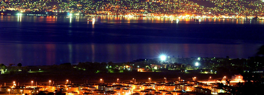
Izmit is located in the vicinity of the Gulf of Izmit. It is a city with two openings to both the Black Sea and the Marmara Sea. It is one of the busiest centers of the country in terms of sea transportation. There are two large seaports (Derince and Yarımca) on the coast of the city, as well as sea port with 34 private piers. The city is one of the important places in terms of the railway and highway connections of the country. Middle East and Asia, road and rail connections also pass through this city.
Economy
Izmit is the 1st most developed city in the country manufacturing industry. Many large company's factories are located in this city. Izmit is close to the industrialization of the economy is based on industrial. It is close to a big commercial center like Istanbul and it allows transit road transportation. 5 state ports, 43 private docks and sea lanes.
The Seka Paper Factory, which has provided Izmit with a distinct economic potential, is also very old (1934). With this factory, the industrial complex that first formed around weaving and forest products later developed around petroleum products with the establishment of Petrol Ofisi (1941), Tüpraş (1960) and Petkim (1965); In recent years, organic chemistry, metal, food, pharmaceutical, fertilizer, paint and shipyard industry has gained a wide diversity.