
Bolu
Bolu ili Yurdumuzun is located in the Western Black Sea Region, between 30º 32 'and 32º 36' east longitudes, 40º 06 'and 41º 01' north latitudes. To the west of Ilimizi, which has an area of 8458 km²; Sakarya and Düzce, southwest; Bilecik and Eskişehir, south; East of Ankara; Çankırı and Karabük, north; There are Zonguldak paintings. There are 8 districts, 4 towns and 511 villages apart from the province center district.Geographical position
Çankırı to the east of Bolu, Karabük to the north, Zonguldak and Karadeniz to the north, Düzce to the west and Ankara to the south. Mountains: 56% of the province's territory. Bolu Mountains in southwest - northeast direction; Highest place 1980 m. And Abant Mountains (1748 m.), Arkot (1877 m.) And Lake Mountains (1112 m.) To the north of Gerede. To the south, the volcanic mountains, which are higher than the first two, and generally referred to as the Köroğlu Mountains (2499 m. The southern extension of Bolu is the Seben Mountains 1854 m. Ardıç Mountains in the vicinity of Mudurnu 1443 m. Çal Tepesi in the south is 1640 m. In height. Plains: The plains covering 8% of the province's area generally extend in the west-east direction. 725 m. Rising Bolu Plain and 1300 m. The rising Gerede Oval are the widest. The other plains are Himmetoglu Plain to the south of Yenice Cave, Mudurnu Plain and Göynük county. Streams: The most important rivers in Bolu are Büyüksu, Mengen Stream, Aladağ Stream, Mudurnu Stream, Göynük Stream, Çatak Stream and Gerede Stream. Lakes: Factors such as the complexity of the morphological structure in the area, the number of streams, elevation differences, and excess slopes have led to the formation of numerous lakes. Smaller areas of basins and bowls have resulted in smaller areas of lakes. Abant Lake, Yeniçağa, Çubuk, Sunnah, Yedigöller, Karagöl, Sülüklügöl, Karamurat are the most important lakes. Climate: Bolu is generally located within the Western Black Sea and Black Sea climate types. In addition, Marmara and Central Anatolian climate types are seen in the southwest sections. The average daily sunshine duration for the last 52 years is 5 hours 49 minutes, annual rainfall 536 mm. The average number of rainy days per day is 137 days. Plant Cover: The dominant vegetation forests in Bolu. 55% of the provincial lands are covered with forests. Karadere, Seben and Aladağ Forests are the richest forests of our country. The dominant tree species are beech, hornbeam, linden, ash, oak, alder, elm, poplar, fir and sultana. Transportation: Bolu, located on the Ankara-Istanbul highway, is only accessible by road. History: BC. Like the whole Hittite territory in 1200 years, Bolu was in the hands of the Phrygians. B.C. In the 6th century Persians dominated the region. B.C. In 336, he defeated the Greater Alexander Persians and seized Bolu like many other places in Anatolia. Upon the death of Alexander the Great, Macedonia collapsed and the Kingdom of Bitinia was established in the Bolu region. Written documents, according to archaeological artifacts and historical sources from those periods, were referred to by the name of people "Bithyn" who settled into the arc of Sakarya and Filyos River at the end of Trak migration. That is why it was called "Bithynia" in northwestern Anatolia, where Bolu is also located. It was changed by Bithynler to the Bolu Plain called Salonia Campus and the name of its surroundings by the Romans as "Claudio Polis". Bolu's name is thought to come from "Police". The city, which was built on three hills, had walls both inside and outside. The remains of these walls can be seen in the Halı Hisarı district in the north of the city. After the victory of 1071 Malazgirt, the Turkmen who spread to the west settled in Bolu after 3 years. Artuk, Tutuk, Danişmend, Karateki and Saltuk Bey, the commanders of the Seljuk State, are based at the Istanbul border at the disposal of Süleyman Shah. During these raids Bolu was conquered by Horasan Aslahaddin. The Ottoman influx to the Bolu region was first initiated by Osman Gazi. The complete conquest of the Bolu region coincides with the first years of the Orhan Gazi period (1324 - 1326). According to another custom, according to the time of the Ottomans, the region was called "Boluluğ" because of its abundance of Ulug - Alim and over time it was named as "BOLU". Bolu was the scene many times for the war of the prisoners who started with the death of Yıldırım Beyazid. As Bolu had stayed outside of the areas that Timur had plundered after the Ankara War, until this danger had ended, Çelebi Mehmet, considered the 2nd founder of the Ottoman State, was also a resort town in Kızık Yaylas. After Çelebi Mehmet's union of the Ottoman State, Bolu had a regular rule. Between 1324 and 1692, Bolu was a star sanctuary with 36 accidents. XVI. In the century Bolu became one of the banners of second degree princes. During the Bayezid period, the Prince Süleyman (Kanuni) was appointed here. Between 1683 and 1792 Bolu was ruled by Voivodship. II. In the time of Mahmut, it was transformed into Mutasarrıflığ. (1811) Bolu after Tanzimat; It was tied to the state of Kastamonu (1864). In 1909 it was transformed into Mutasarrýlýð. Following the entry of the Mondros Armistice and the occupation of İzmir, the first Müdafa-i Hukuk Cemiyeti Gerede was organized in Bolu region. During and after World War I, the enemy did not suffer an occupation but suffered financial damage. At the end of the national struggle periods under the leadership of Mustafa Kemal Pasha, Bolu completed the period of Mutasarity in October 10, 1923 and became a province.
Coming Soon
Coming Soon
Coming Soon
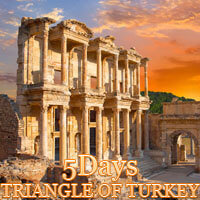
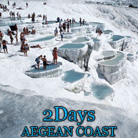
Best Seller Tours