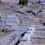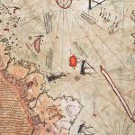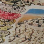
The Map of Piri Reis Istanbul – Chapter 2,
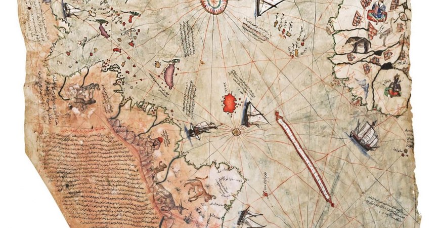
The largest of these two maps, known as Piri Reis’s map of America, is kept in Topkapi Palace Museum and measures 90 cm. by 65 cm. The map is drawn with colored pens on soft gazelle skin and includes explanations. According to an inscription on it, the map was drawn by Piri Reis himself in Gallipoli between March and April of 1913.
Piri Reis was born in Gallipoli in 1470, brought up by his uncle Kemal Reis, a well-known sailor who took him on voyages. Piri Reis, an accomplished poet as well as a sailor, later became admiral of the Ottoman navy, dying in 1554 at the age of 85. He wrote the Naval Book, a very important navigational work illustrated with maps which have been translated into many languages and printed. The first question which was asked when the Piri Reis map was found was: ‘How did Piri Reis draw this map? Did he go to America which was as yet still an unknown continent discovered by Christopher Columbus only 24 years previously? If he had not gone where did he learn of the new continent in such detail?’ Piri Reis answers these questions in the notes he wrote on the map. He says the following: ‘I drew this map with the guidance of 20 other maps, among them Arabic, Indian, and Chinese maps and Christopher Columbus’s map of the western world and also the true and authentic maps of the Portuguese sailors’. Experts who have studied it say that Piri Reis made extensive use of the maps of Central America drawn by Christopher Columbus and Toskanelli in 1498, using names given by them to islands and shores on his map.
You will continue to find the details of the map of Piri Reis in chapter 3.